
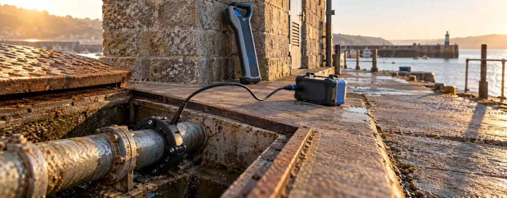
Utility Detection & Mapping in Cudworth
Get in TouchAt Site Signal Surveys, we specialise in utility detection and mapping services across Cudworth. Our expert team uses advanced techniques, such as ground-penetrating radar and electromagnetic location, to accurately detect and map underground utilities.
We cater to a wide range of projects, ensuring comprehensive and precise surveys that support construction safety and planning in the S72 8 area. Reach out to us for reliable utility detection and mapping solutions.
What Is Utility Detection & Mapping?
Utility detection and mapping involve identifying and charting the location of underground utilities. At Site Signal Surveys, we use ground-penetrating radar (GPR) combined with electromagnetic location to pinpoint the positions of pipes, cables, and other infrastructure beneath the surface in Cudworth.
GPR can detect non-metallic pipes and ducts, while electromagnetic location is effective for tracing metallic cables and pipes by inducing signals on them.
Our team adheres to the PAS 128 standard for underground utility detection, ensuring that our surveys are conducted with precision and reliability. By accurately mapping utilities, we minimise the risk of service disruptions and safety hazards that could otherwise occur due to accidental drilling or excavation.
This service is indispensable for construction firms, civil engineering projects, and municipal planning authorities, facilitating efficient and secure project planning and execution. We invite you to contact us for a consultation tailored to your specific project needs.
How Much Does Utility Detection & Mapping Cost in Cudworth?
Utility detection and mapping typically cost from £250 to £750 per day in Cudworth. The exact cost depends on factors such as the site's size, accessibility, and the complexity of the underground infrastructure.
Factors like the type of utilities to be detected, such as gas, water, electric, or telecommunications, also influence the pricing. We employ methods like ground-penetrating radar (GPR) and electromagnetic location (EML) to ensure precise results.
Additionally, the presence of obstacles such as reinforced concrete or historic structures may require more specialised equipment or techniques that can affect pricing. Our team at Site Signal Surveys can provide a tailored quote based on your specific needs and site conditions.
We are equipped to service properties ranging from residential sites to large commercial developments. Get in touch with us today to discuss your project's requirements.
Book Utility Detection & Mapping Today
Why Choose Site Signal Surveys for Utility Detection & Mapping in Cudworth?
Choosing Site Signal Surveys for your utility detection and mapping needs in Cudworth ensures access to a highly skilled team and the latest technology. We use Ground Penetrating Radar (GPR) and Electromagnetic Location (EML) tools to detect subsurface utilities with precision.
Our surveyors are not only trained in PAS 128 standards for underground utility detection but also have extensive experience with diverse terrains and project scales, from small residential properties to complex commercial developments. Our GeoSLAM technology allows 3D mapping of utility layouts, capturing every detail including depth and material type.
We prioritise accuracy and safety in all our surveys and are committed to delivering precise results that aid in the safe and efficient planning of construction projects. By adhering to BSI standards, we mitigate risks such as accidental cable strikes, which can lead to costly delays.
Contact us to learn more about our services and how we can assist your project in the S72 8 area.
What Types of Utility Detection & Mapping Are Available in Cudworth?
We offer several types of utility detection and mapping services in Cudworth, equipped to handle various site challenges and conditions.
Ground-Penetrating Radar (GPR): Uses radar pulses to image the subsurface, suitable for a variety of environmental conditions, and effective for identifying non-metallic objects such as plastic pipes and voids.
Electromagnetic Location: Ideal for detecting metallic pipes and cables using electromagnetic fields, and is compatible with identifying live electrical cables through signal induction.
CCTV Drain Surveys: Provides visual inspections for drainage systems, helpful in diagnosing blockages, structural damage, or root intrusion, allowing for precise repair planning.
In addition to these, we also offer utility mapping using GPS integration for accurate geospatial data collection, which can be crucial for creating detailed as-built drawings. Our diverse range of methods allows us to choose the most suitable approach for each unique site.
To understand more about how these services can assist your project, feel free to contact us.
How Does Utility Detection & Mapping Work?
Utility detection and mapping in Cudworth involve the following steps:
Site Assessment: We evaluate the site conditions, considering soil type, geology, and existing site plans, to assess potential utility locations. This helps us determine the most suitable detection methods for each site.
Equipment Setup: We deploy appropriate detection equipment such as Ground Penetrating Radar (GPR) or electromagnetic locators. GPR is ideal for non-metallic utilities, while electromagnetic locators are effective for metallic pipes and cables.
Data Acquisition: Our team collects data using the selected detection methods, recording depth and spatial data of the utilities at strategic grid points for comprehensive coverage.
Data Analysis: We analyse the data using specialised software to map the position of underground utilities accurately. This involves cross-referencing multiple detection signals to verify utility locations.
Reporting: We deliver comprehensive reports with detailed maps of identified utilities, including annotations of utility types, depths, and positions. We ensure reports are compliant with industry standards like PAS 128 for utility surveys.
Get in touch with us to understand more about our detailed process.
How Long Does Utility Detection & Mapping Take?
The duration of utility detection and mapping projects typically ranges from a single day to several days in Cudworth, depending on the size and complexity of the site. For smaller areas, such as standard residential plots, we might complete the work within a few hours using ground-penetrating radar (GPR) to detect utilities like water and gas lines.
However, larger commercial or industrial sites may take longer, possibly two to three days, as we deploy additional techniques such as electromagnetic location (EML) to map underground cables and pipes.
Our experienced team at Site Signal Surveys uses equipment calibrated to British Standards BS EN 61010-1, ensuring both safety and precision. We also provide detailed reports that include CAD drawings and GIS data, allowing for seamless integration with your project plans.
Contact us to arrange a survey and receive a project timeline tailored to your needs.
Speak to a Utility Detection & Mapping Expert
Frequently Asked Questions
How often should utility detection be carried out?
It is recommended to perform utility detection and mapping before any construction or excavation project begins to avoid damaging existing utilities.
Is utility detection necessary for small projects?
Yes, utility detection is important even for small projects to ensure safety and prevent costly repairs from accidental damage.
What equipment do you use for utility detection?
We primarily use ground-penetrating radar and electromagnetic locators for utility detection and mapping.
How accurate is the utility mapping process?
Our utility mapping process provides accuracy typically within a few centimetres, depending on the site's conditions and the methods used.
Can you detect non-metallic pipes?
Yes, we use ground-penetrating radar to detect non-metallic pipes, providing thorough underground mapping.
Get a Free Quote for Utility Detection & Mapping in Cudworth
For accurate and reliable utility detection and mapping in Cudworth, contact Site Signal Surveys.
We cover Cudworth (South Yorkshire)